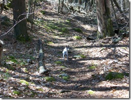
 There’s a place in Cohasset, MA off of route 3a where I love to go with my Sweetheart Beth & my dog Skippy for a walk & short hike. It’s called Whitney & Thayer Woods. Not being real close to any real mountains where I live, this place still provides a good way to enjoy nature & stretch the leg muscles some.
Whitney & Thayer Woods is one of 95 properties owned by The Trustees Of Reservations in MA, comprised of more than 800 acres and over 10 miles of trails within its boundaries. Many of the paths & trails are named after early benefactors of the organization, such as 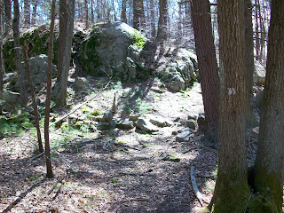 Milliken Memorial Path. In the late 1920s Arthur N. Milliken planted many flowering shrubs as a memorial to his wife, Mabel Minott Milliken. Rhododendrons still bloom here each spring. A grouping of glacial erratics mark certain areas of the landscape, such as Ode’s Den. This was named after Theodore “Ode” Pritchard who, after losing his home in 1830, lived under one of the boulders. Bigelow Boulder was named in honor of the late author of the first volume of The Narrative History Of Cohasset.
The Trustees Of Reservations website gives a good synopsis of this beautiful landscape. Here’s an excerpt from the website:
Much of Whitney & Thayer Woods was originally the “Common Lands of the Hingham Planters,” referring to the colonists who settled the area beginning around 1634. Around 1904, Henry M. Whitney began purchasing parcels of abandoned farmland to create a private estate. The Whitney Woods Association later acquired much of the estate and donated more than 600 acres to The Trustees Of Reservations in 1933. Ten years later, Thayer Woods was also donated, and the Reservation became known as Whitney & Thayer Woods.
The property sits adjacent to another piece of land also owned by the The Trustees, 62 acre Turkey Hill. This area is co-managed by the towns of Cohasset & Hingham and is situated close to Weir Farm. Sitting atop the 187 ft summit of Turkey Hill is the remains of an anti-missile radar control station, built at the time of the cold war & used to help thwart potential nuclear attacks by the then known Soviet Union. It’s a basic cinder block structure, now stripped & empty of any equipment it once housed.
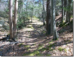
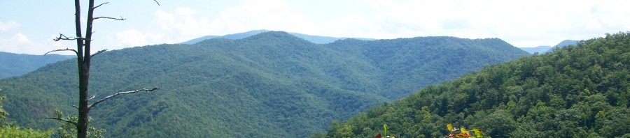
These two properties make for a great day hike, and if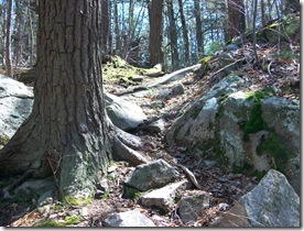 starting from Whitney Woods, you can incorporate a picnic atop Turkey Hill in the spring & summer months. There are several paths within Whitney & Thayer Woods which pass through heavily wooded areas, as well as old carts paths outlining the perimeter of the property. The terrain varies with ups & downs, rocky outcrops & wooden bridges crossing streams & wet areas. The wider paths are used by mountain bikers & runners on a daily basis. During the winter months, the trails are used for both cross-country skiing & snowshoeing.
A walk around the property at Whitney & Thayer Woods is roughly 2-3 hours. There are bulletin boards providing printed trail maps in designated parking areas, and you can even download a copy from http://www.thetrustees.org/pages/21_trail_map_library.cfm. Many of the secondary trails within the property’s confines aren’t marked on the map, though markers are placed throughout along the trails & paths. It’s possible that some trails or markers are mis-marked, as a couple spots on the map don’t agree with the physical terrain. This is been a discussion between Beth & I more than once.
On The Trustees Of Reservations website is listed that interpretive tours & programs are offered during the year. I’ve never signed up for one, nor do I know anyone who has. If you want more information on this, check out their website.
Here’s some other links below with information regarding Whitney & Thayer Woods:
http://www.thetrustees.org/pages/392_whitney_and_thayer_woods.cfm
http://www.thetrustees.org/pages/21_trail_map_library.cfm


